Smart India Hackathon (SIH 2026)
Problem Statement ID: 26175
Organization: Indian Space Research Organisation (ISRO) / Department of Space
Theme: Disaster Management
Category: Software
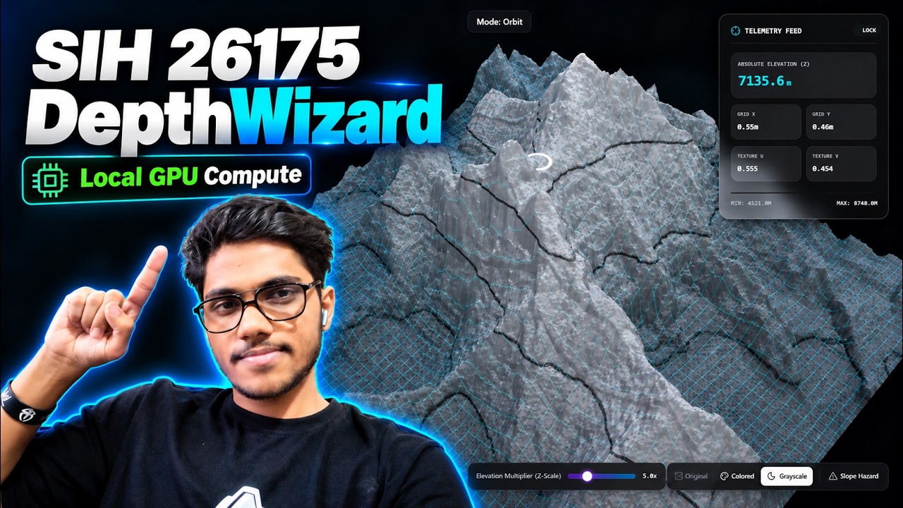
DepthWizard is an end-to-end web platform designed for the Indian Space Research Organisation (ISRO) to transform single-view 2D optical satellite imagery and Digital Elevation Models (DEMs) into interactive, metric-accurate 3D terrain assets.
By combining deep learning monocular depth estimation backbones (ZoeDepth and DepthAnythingV2) with high-performance C-level GIS ingestion (Rasterio / GDAL) and GPU-accelerated WebGL rendering (Three.js / GLSL Shaders), DepthWizard bridges the gap between static remote-sensing rasters and real-time interactive 3D flight reconnaissance in the browser.
Features real-time GPU slope hazard classification, least-squares GCP affine calibration, 1024x1024 high-fidelity mesh engine, and 1-click export to .OBJ, .PNG, and 32-bit GeoTIFF.
| Kedarnath Valley — Hypsometric Elevation | Kedarnath Valley — Topographic Contours |
 |
 |
| Structural Wireframe Overlay | Dynamic Solar Hillshading |
 |
 |

Figure 1: High-resolution 1-channel GeoTIFF elevation raster of the Kedarnath Valley rendered with GPU-accelerated procedurals.
Introduced dark-mode glassmorphism interface and 60 FPS raycasting telemetry.
| Tactical Dashboard Layout | Martian Mountains Topography |
 |
 |
| Martian Surface Angled View | Lunar Surface Telemetry HUD |
 |
 |
Initial proof-of-concept pipeline translating optical 2D satellite rasters into 3D meshes.
| Global Topography | UK Coastal Raster | Burj Khalifa Overhead |
 |
 |
 |
- Autonomous FPV Drone Flythrough: Resolved frame-delta locks allowing seamless First-Person View (FPV) flight through the 3D terrain using keyboard and mouse controls.
- GCP UI/UX Enhancements: Streamlined calibration pinning workflow and real-time metrics telemetry.
-
Real-Time 3D Slope Hazard Heatmap (Landslide Risk Assessment):
- Instant GPU-accelerated terrain gradient calculation classifying slopes into:
- 🟩 Safe Zone (
$0^\circ - 30^\circ$ ):#22c55e(Emerald Green) - 🟨 Warning Zone (
$30^\circ - 45^\circ$ ):#eab308(Amber Yellow) - 🟥 High Landslide Risk (
$> 45^\circ$ ):#ef4444(Crimson Red)
- 🟩 Safe Zone (
- Compensates for artificial
$Z$ -scale visual exaggeration so physical slope angles remain geometrically accurate. - Includes a dedicated tactical glassmorphic HUD legend card.
- Instant GPU-accelerated terrain gradient calculation classifying slopes into:
-
Interactive GCP (Ground Control Point) Metric Scale Calibration:
- Interactive pinning tool allowing operators to place 3+ known elevation GCPs directly on the 3D terrain.
- Fits an absolute least-squares affine transformation model (
$\text{Height} = \alpha \cdot d_{\text{rel}} + \beta$ ). - Real-time
$R^2$ goodness-of-fit and RMSE (Root Mean Square Error) telemetry readout.
-
1-Click Multi-Format Geospatial Export Suite:
- 📦 3D Mesh (
.OBJ): Exports reconstructed Wavefront 3D terrain geometry with calibrated affine scaling for Blender, Unity, and Unreal Engine. - 🖼️ DEM Raster (
.PNG): High-contrast 8-bit elevation raster matrix. - 🗺️ Scientific GeoTIFF (
.tif): 32-bit floating-point metric GeoTIFF with embedded Ground Sample Distance (GSD) for QGIS and ArcGIS.
- 📦 3D Mesh (
-
High-Fidelity Mesh Engine: Dynamic toggle between standard
512x512and ultra-dense1024x1024vertex resolution grids for micro-terrain fidelity. - Zero-Latency Client WebGPU Fallback: Integrated ONNX Runtime Web for local in-browser depth inference.
- 500MB+ GeoTIFF Scale Unlock: Completely dismantled file-size constraints to support high-density satellite rasters, Sentinel-2 imagery, and SRTM DEM datasets up to 500MB+.
- Native DEM Bypass Pipeline: Automatically detects single-band floating-point GeoTIFFs, bypassing neural depth estimation to preserve absolute metric height scales without squashing terrain features.
- Quad Texture Shading Modes:
- Colored Mode: Procedural 7-color Hypsometric Tinting (
#1b382bemerald valley to#f8f9faglacial peak). - Grayscale Mode: Mathematical Rec. 601 luminance desaturation (
dot(topoColor, vec3(0.299, 0.587, 0.114))) preserving identical contour features in high-contrast black-and-white. - Original Mode: Overlays true-color optical RGB satellite textures on the physical mesh.
- Slope Hazard Mode: Real-time slope steepness classification for disaster reconnaissance.
- Colored Mode: Procedural 7-color Hypsometric Tinting (
- Expanded Vertical Exaggeration: Dynamic Z-Scale slider expanded up to 25.0x for deep ravine and cliff visualization.
- Rasterio GIS Engine Integration: Replaced legacy image parsers with GDAL-backed
rasterioto safely spool single-band 32-bit floating-point TIFFs and extract spatial Ground Sample Distance (GSD). - GPU Shaders (
onBeforeCompile): Offloaded procedural colormapping, topographic contour rendering (fwidthderivatives), and tactical grid overlays to custom WebGL GLSL fragment shaders. - Physical CPU Vertex Displacement & Lighting: Physical CPU/GPU vertex displacement (512x512 / 1024x1024 grid) and procedural normal computation for realistic directional solar hillshading.
-
Real-Time Telemetry HUD: 60 FPS mouse-hover raycasting displaying 3D world coordinates
$(X, Y, Z)$ , relative elevation percentage, estimated height ($m$ ), and UV coordinates. - Offscreen Canvas Caching: Zero-latency pixel caching bypassing WebGL read-pixel GPU bottlenecks.
- Aerospace Dark-Mode UI: Revamped glassmorphism tactical control panel built for high legibility during operations.
- End-to-End Pipeline: Established FastAPI + PyTorch backend communicating with React/Vite Three.js frontend.
- Monocular Inference: Relative depth estimation powered by DepthAnythingV2.
Unlike early prototype drafts, the following capabilities have been fully resolved and deployed in production:
- Real-Time Slope & Landslide Hazard Shader: Solved in v1.4.0. Physical surface gradient classification (
$0^\circ-30^\circ$ safe,$30^\circ-45^\circ$ warning,$>45^\circ$ danger) with interactive HUD card. - Interactive GCP Metric Scale Calibration: Solved in v1.4.0. Least-squares affine solver (
$\text{Height} = \alpha \cdot d_{\text{rel}} + \beta$ ) with live$R^2$ and RMSE telemetry. - Multi-Format Export Suite: Solved in v1.4.0. 1-click export to
.OBJ3D mesh, 8-bit DEM.PNG, and 32-bit floating-point.tifGeoTIFF for QGIS/ArcGIS. - ZoeDepth & Real-World Metric Depth Calibration: Solved in v1.1.0/v1.3.0 via
backend/services/depth_engine.py. Operates natively alongside DepthAnythingV2 for absolute metric depth estimation. - Aerospace UI Rebuild: Solved in v1.2.0. Complete dark-mode glassmorphism interface overhaul with responsive sidebars and dynamic HUD telemetry.
- 1-Band Scientific GeoTIFF Support: Solved in v1.3.0/v1.3.1. High-throughput
rasterioGDAL C-engine integration for single-channel elevation rasters. - Automated GIS Math Testing & CI: Pytest unit test suite validating GeoTIFF ingestion, GSD resolution scaling, and GCP affine calibration.
- Autonomous FPV Drone Flythrough: Solved in v1.4.1. Fully functional WASD + Mouse First-Person camera controls synced with real-time
deltaframerates.
                              [ User Upload ]
                       (JPG, PNG, or 1-Band GeoTIFF)
                                     │
                                     ▼
                ┌────────────────────────────────────────┐
                │          FastAPI Backend Engine        │
                ├────────────────────────────────────────┤
                │ 1. Rasterio / GDAL GIS Parser          │
                │ 2. Single-Band vs RGB Auto-Detection   │
                │ 3. ZoeDepth / DepthAnythingV2 PyTorch  │
                │ 4. Native Metric DEM Preservation      │
                │ 5. Least-Squares GCP Affine Solver     │
                │ 6. 32-bit GeoTIFF Export Generator     │
                └────────────────────────────────────────┘
                                     │
                                     ▼
                      [ Normalized Height Array ]
                       + Texture Base64 Payload
                                     │
                                     ▼
                ┌────────────────────────────────────────┐
                │          Three.js WebGL Frontend       │
                ├────────────────────────────────────────┤
                │ 1. 512x512 / 1024x1024 Grid Geometry   │
                │ 2. Procedural View-Space Normals       │
                │ 3. Quad GLSL Shader Pipeline:          │
                │    - 7-Color Hypsometric Topography    │
                │    - Rec. 601 Luminance Grayscale      │
                │    - Optical RGB Texture Projection    │
                │    - GPU Slope Landslide Hazard Map    │
                │ 4. Offscreen Canvas HUD Telemetry      │
                │ 5. Multi-Format Exporter (.OBJ / .PNG) │
                └────────────────────────────────────────┘
| Requirement | ISRO PS 26175 Specification | DepthWizard Implementation |
|---|---|---|
| Non-Georeferenced RGB | Produce Relative Digital Surface Model (rDSM) for PNG/JPG | ZoeDepth / DepthAnythingV2 monocular depth extraction with WebGPU fallback |
| Georeferenced RGB / TIFF | Produce Absolute Digital Surface Model (DSM) for GeoTIFF | Native 1-band float32 GeoTIFF parsing with rasterio and metric preservation |
| Scale Calibration | Calibrate relative depth to absolute metric units ( |
Interactive GCP pin placement with least-squares affine fitting ( |
| 3D Rendering Engine | Project optical image onto generated 3D mesh in WebGL | Three.js shader pipeline with high-fidelity displacement (512x512 / 1024x1024) |
| Interactive Navigation | First-person & aerial 3D terrain analysis | 60 FPS orbit controls, Autonomous FPV Flythrough, and raycasting HUD |
| Disaster Management | Support structural height, slope, and terrain analysis | Real-time GPU slope hazard heatmap ( |
| GIS Interoperability | Export to standard geospatial and 3D formats | 1-click export to 32-bit float GeoTIFF (.tif), Wavefront 3D Mesh (.OBJ), and DEM (.PNG) |
DepthWizard bridges the gap between web-based interactive exploration and production GIS pipelines by enabling 1-click downloads across three industry-standard formats:
| Format | Extension | Target Use Case | Technical Pipeline |
|---|---|---|---|
| Wavefront 3D Mesh | .OBJ |
3D Visualization, Blender, Unity, Unreal Engine | CPU vertex extraction with affine elevation scaling ( |
| DEM Elevation Raster | .PNG |
Fast 2D preview, raster heightmaps | 8-bit high-contrast grayscale normalization matrix |
| Scientific GeoTIFF | .tif |
QGIS, ArcGIS, Hydrological & Slope Modeling | 32-bit floating-point raster encoded via rasterio with spatial GSD resolution tags |
Designed specifically for the ISRO Disaster Management theme, DepthWizard features a real-time GPU-accelerated Slope Hazard classification engine:
-
Physical Slope Extraction: Computes exact terrain gradients in real time using partial derivatives (
dFdx,dFdy) on the world-space mesh. - Z-Scale Neutralization: Automatically cancels artificial visual vertical exaggeration so physical slope angles remain true to reality.
-
Tactical Classification:
- 🟩 Safe Terrain (
$0^\circ - 30^\circ$ ): Flat plains and gentle foothills. - 🟨 Warning Slope (
$30^\circ - 45^\circ$ ): Moderate inclines requiring monitoring. - 🟥 High Landslide Risk (
$> 45^\circ$ ): Dangerous steep ravines and escarpments prone to slope failure.
- 🟩 Safe Terrain (
- Glassmorphic HUD Legend: Displays an automated tactical overlay card when Slope Hazard mode is activated.
For non-georeferenced optical images, DepthWizard allows field operators to calibrate relative depth into authentic metric heights (
- Pinning Mode: Click anywhere on the 3D terrain to pin known reference landmarks (e.g. river level, valley floor, mountain peak).
-
Elevation Assignment: Enter known ground-truth elevations (
$m$ ) for 3+ control points. -
Least-Squares Solver: Solves the linear affine system
$\text{Height} = \alpha \cdot d_{\text{rel}} + \beta$ and outputs live goodness-of-fit telemetry:-
$R^2$ Score (Correlation coefficient) - RMSE (Root Mean Square Error in meters)
-
- Live GPU Adaptation: Instantly updates shader uniforms and mesh geometry without reloading.
- Language: Python 3.10+
- API Framework: FastAPI (Uvicorn ASGI)
- ML Engines: PyTorch, HuggingFace Transformers (ZoeDepth, DepthAnythingV2)
- GIS Processing: Rasterio, GDAL C-Engine, OpenCV, NumPy
- Core Framework: React 18 + Vite (TypeScript)
- Rendering Engine: Three.js /
@react-three/fiber/@react-three/drei - Styling: Vanilla CSS & Tailwind CSS (v4)
- State Management: Zustand
Tip
Zero-Troubleshooting Deployment: Avoid CUDA, Python version, Node, and C-level GDAL dependency mismatches by running the entire stack in isolated containers with a single command:
git clone https://github.com/jhaabhijeet864/DepthWizard.git
cd DepthWizard

# Build and launch both Backend and Frontend instantly:
docker compose up --build- Access the Frontend Web App:
http://localhost:5173 - Access the Backend FastAPI Swagger Docs:
http://localhost:8001/docs
- Python 3.10 or higher
- Node.js v18.0 or higher
- npm or yarn
- GDAL Binaries (for scientific GeoTIFF parsing via
rasterio)
Important
rasterio depends on C-level GDAL binaries. Ensure system GDAL libraries are installed prior to running Python pip dependencies:
- Windows: Modern PyPI wheels package pre-compiled GDAL binaries (
pip install rasterio). Alternatively, use Conda:conda install -c conda-forge rasterio
- Linux (Ubuntu / Debian):
sudo apt-get update && sudo apt-get install -y gdal-bin libgdal-dev - MacOS:
brew install gdal
git clone https://github.com/jhaabhijeet864/DepthWizard.git
cd DepthWizardNote
The backend server runs on Port 8001 (shifted from 8000 to prevent socket collisions with system services on Windows).
cd backend
python -m venv venv

# Windows Activation:
.\venv\Scripts\activate

# Linux / MacOS Activation:
source venv/bin/activate

pip install -r requirements.txt
uvicorn main:app --reload --port 8001
Backend API service will run at http://localhost:8001 (Swagger documentation available at http://localhost:8001/docs)
Open a new terminal window:
cd frontend
npm install
npm run dev
Frontend web application will run at http://localhost:5173
- Abhijeet Jha — Team Leader & AI/ML Engineer
- Rohan Jha — AI Engineer & Documentation Lead
- Aman Sharma — Backend & Code Maintenance Lead
- Ayush Saxena — Backend Lead
- Suruchi Kumari — Frontend & UI/UX Lead
- Shreyashi Dwivedi — Research and Presentation Lead