English | 简体中文 | 日本語 | 한국어 | Türkçe | Deutsch | Русский | Français | Español | Italiano | العربية | Português (Brasil)
OrthoViewer is a local-first, browser-based GeoTIFF viewer built for people who need to open, inspect, annotate, measure, and present large geospatial raster imagery without launching a heavy desktop GIS package.
Open the platform here: https://orthoviewer.splatting3d.com/
If you work with drone mapping deliverables, UAV orthomosaics, aerial survey imagery, satellite scenes, tiled GeoTIFF files, BigTIFF rasters, or local orthophoto archives, OrthoViewer gives you a direct way to view the file in the browser, keep the data on your machine, and move quickly from inspection to communication.
The short video below introduces the OrthoViewer workflow: open a large raster, move through the map, add useful context, and turn a geospatial image into something easier to review and share.
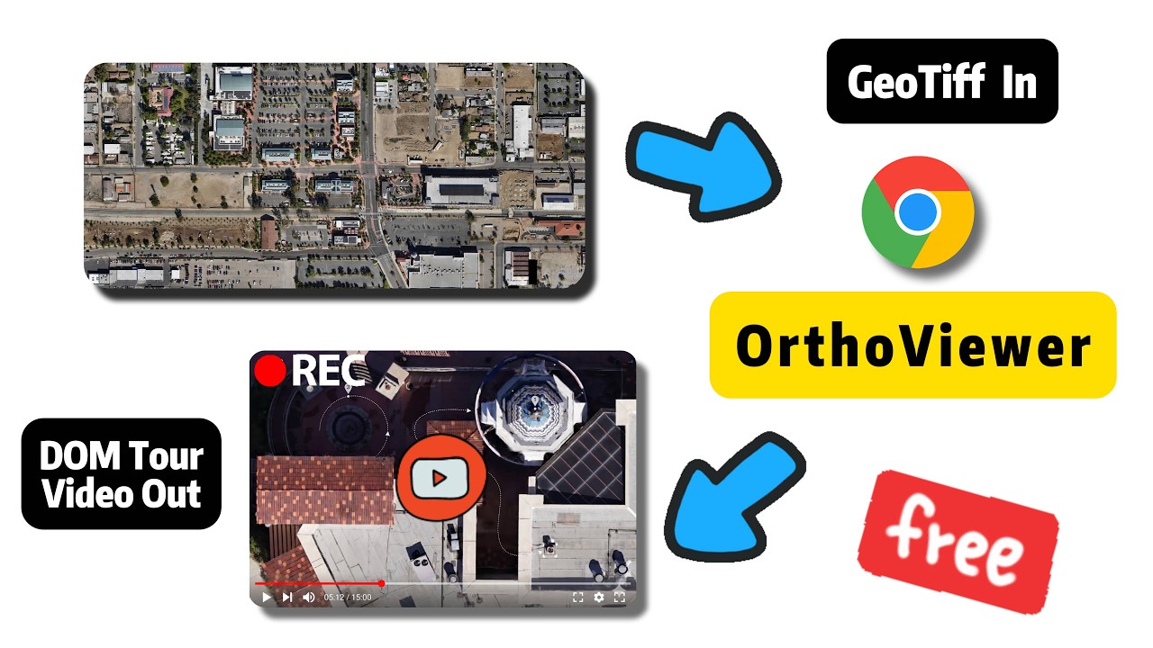
Direct video link: https://www.youtube.com/watch?v=GVZg_SMNAHM
Many GIS workflows are powerful but heavy. Sometimes you do not need a full desktop GIS project, a remote tile server, or a long import process. You simply need to answer questions like:
- Can I open this large GeoTIFF or BigTIFF file quickly?
- Is this orthomosaic aligned, complete, and visually clean?
- Can I mark a point, draw a line, outline an area, and export the result as GeoJSON?
- Can I create a short guided map tour or browser-rendered video for a client, teammate, or stakeholder?
- Can I keep this review lightweight without building a full GIS project?
OrthoViewer focuses on that practical viewing and review loop. It is a fast online GeoTIFF viewer for local files, an orthophoto viewer for large raster deliverables, a raster map viewer for quick QA, and a lightweight web GIS workspace for annotation and presentation.
Local-first file handling. You open a local .tif or .tiff file from your browser. The product is built around browser-local processing rather than requiring upload before viewing.
Large-raster navigation. The viewer uses tiled rendering, worker-side GeoTIFF processing, cache warming, and MapLibre-powered pan and zoom so massive imagery can be explored with a desktop-style map feel.
Action after viewing. OrthoViewer emphasizes point, line, and polygon annotation on DOM imagery, practical measurement tools, GeoJSON vector export, guided map tours, and local video export.
Drag and drop a GeoTIFF or choose a local file from the homepage. OrthoViewer parses the TIFF index, detects source image levels, and mounts the raster into a map-style workbench. You can open one file for inspection or select two aligned .tif / .tiff files to enter comparison mode.
After a file opens, OrthoViewer presents it as an interactive raster map. You can pan, zoom, and inspect the image in a familiar map interface. Under the hood, OrthoViewer uses a custom geotiff:// tile protocol with MapLibre rendering, visible-viewport tile priority, background cache warming, and browser-side generated WebP raster tiles.
OrthoViewer can open two local GeoTIFF files at the same time for visual comparison when the files include compatible CRS and transform metadata. Comparison mode supports synchronized map cameras, left/right or top/bottom side-by-side layouts, and draggable swipe comparison in horizontal or vertical directions.
This is useful for before/after surveys, design-vs-built checks, repeated drone flights, seasonal imagery, construction progress, and quality review between two raster deliverables. In swipe mode, tour keyframes can also remember the swipe position so a guided presentation can show the same comparison state during playback.
The workbench includes a GeoTIFF metadata dialog for file size, TIFF format, storage layout, image dimensions, tile size, compression, GeoKeys, model transform fields, source levels, NoData, and related document tags where available. A small overview map can show the full raster extent and current viewport while you navigate.
For visual inspection, the image enhancement panel provides presets and manual controls for contrast, brightness, saturation, and sharpness. These adjustments are browser-side viewing aids; they help review low-contrast orthophotos, washed-out site imagery, or dense raster detail without changing the original file.
OrthoViewer includes a dedicated DOM annotation and measurement workspace. DOM usually means Digital Orthophoto Map in geospatial production workflows: a corrected orthophoto or orthomosaic that can be used as a map-like raster reference.
- Point annotations for locations, defects, control points, field notes, or inspection targets.
- Line annotations for roads, boundaries, transects, utility runs, access routes, and distance checks.
- Polygon annotations for parcels, work zones, roof sections, crop plots, cut/fill regions, or areas of interest.
The workflow is designed to be fast enough for field review and client-facing QA: choose a point, line, or polygon tool, click on the DOM raster, label the result, and keep drawing. Measurements can be shown or hidden, and supported datasets can use geodesic or cartesian measurement modes.
After drawing point, line, and polygon annotations on a DOM, orthophoto, or orthomosaic, you can export the result as a GeoJSON vector file for GIS software, reports, automation pipelines, or issue tracking. The standalone annotation workspace can also import GeoJSON features, place them on the map when the raster contains the required georeference metadata, group annotations by geometry type, show labels and measurements, and re-export the updated set.
The map tour editor also supports GeoJSON overlay import for project boundaries, known features, planned work areas, or issue layers. Imported overlay features can be shown during tour editing and optionally included when exporting tour annotation GeoJSON. GeoJSON placement and export depend on the GeoTIFF containing the required model transform and coordinate reference information.
OrthoViewer includes a map tour editor for saved map views through a GeoTIFF. Add keyframes, rename stops, adjust timing, add annotation text, pick point/line/polygon callout geometry, resize annotation text boxes, choose landscape 16:9 or portrait 9:16, configure intro/outro branding, preview playback, and export tour JSON.
The editor includes an onboarding walkthrough, import/export for tour JSON, a reorderable keyframe rail, configurable resolution and frame-rate presets for video export, and comparison-aware controls when two rasters are open. In comparison workflows, primary and secondary maps can have independent annotation text while sharing the same point, line, or polygon geometry.
When the browser supports the selected video encoding settings, OrthoViewer can render tour frames locally and export a video from the guided map sequence. This is useful for client updates, drone mapping progress reports, site inspection explainers, and presentation clips from geospatial raster imagery.
The platform includes a language selector and localized interface strings for English, Simplified Chinese, Japanese, Korean, Turkish, German, Russian, French, Spanish, Italian, Arabic, and Brazilian Portuguese. The viewer remains browser-local regardless of the selected language.
- Quick GeoTIFF review: open a tiled GeoTIFF or BigTIFF, pan and zoom, use metadata and overview panels, adjust image enhancement, then open annotation or tour tools when you need shareable output.
- Two-raster comparison: open two aligned GeoTIFFs, switch between swipe and side-by-side views, compare left/right or top/bottom layouts, and capture comparison states in map tour keyframes.
- DOM / orthomosaic QA: check seams, gaps, blurred areas, edges, roof details, crop plots, or survey coverage; add point, line, or polygon annotations; show geodesic or cartesian measurements; export GeoJSON.
- GeoJSON overlay comparison: import project boundaries or known features, compare them with the raster, and export new annotations or tour annotation data.
- Client-friendly map tour and video: save keyframes, add explanatory annotation text and geometry, preview playback, and export a video if your browser supports the selected settings.
OrthoViewer is built for local tiled GeoTIFF workflows, including Classic TIFF and BigTIFF indexing, IFD and subIFD level discovery, tiled TIFF block access, overview selection from existing TIFF pyramid levels, worker-based parsing and decoding, browser cache management, and common TIFF compression types where browser support allows.
Important compatibility note: OrthoViewer targets tiled GeoTIFF files. Stripped TIFF storage is not supported in the current viewer, so stripped TIFFs should be converted to tiled GeoTIFF before opening.
Two-file comparison additionally requires georeference metadata that can place the secondary raster in the primary map space. Files with missing CRS, unsupported CRS, missing transform metadata, or mismatched coordinate reference systems cannot be compared in the current browser viewer.
This repository is used as the documentation, product feedback, and requirement collection space for the OrthoViewer platform. If you find a problem, want to suggest a workflow improvement, need support for a specific GeoTIFF or DOM production scenario, or have an idea for a better annotation, measurement, GeoJSON, or video tour experience, you are welcome to open an issue.
Public repository: https://github.com/Splatting3D/OrthoViewerDoc
Helpful issue reports include the browser and operating system, the raster type involved, the workflow you were trying to complete, screenshots or sample files when shareable, and the desired behavior for annotation measurement, vector export, tour editing, or video export.
https://orthoviewer.splatting3d.com/
Bring a tiled GeoTIFF, BigTIFF, orthophoto, or orthomosaic file and explore it directly in your browser.
GeoTIFF viewer, online GeoTIFF viewer, browser GeoTIFF viewer, TIF viewer, orthophoto viewer, orthomosaic viewer, DOM viewer, DOM annotation, DOM measurement, geospatial raster viewer, raster map viewer, drone mapping QA, UAV orthophoto inspection, GeoTIFF comparison, orthomosaic comparison, swipe comparison, side-by-side raster comparison, image enhancement, GeoTIFF metadata, overview map, point annotation, line annotation, polygon annotation, distance measurement, area measurement, geodesic measurement, cartesian measurement, GeoJSON import, GeoJSON overlay, GeoJSON vector export, web GIS annotation, guided map tour, browser video export, local-first GIS.